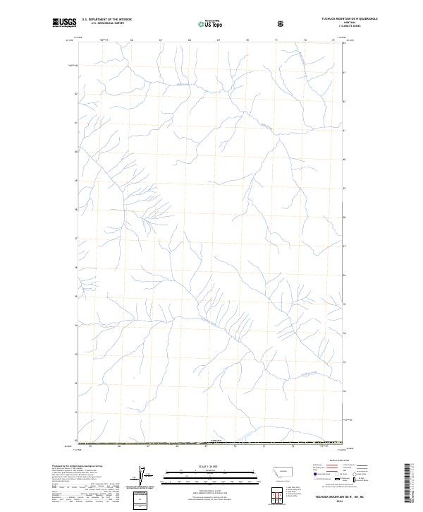
2024 Map of Tuchuck Mountain OE N
USGS Topo · Published 2024About this map
Canada marks the southern extent of this 2024 map, where the international boundary separates the United States from its northern neighbor. The terrain is defined by a dense network of mountain streams and drainage basins. Two primary water systems, Cabin Creek and Couldrey Creek, dominate the central and southern portions of the sheet, while Storm Creek flows in the northeast corner. This map represents a modern topographic study of the Flathead region, capturing the remote drainage patterns near the border. The absence of roads or established settlements within the quadrangle indicates a largely undeveloped wilderness area, where the primary landmarks are the natural watercourses and the survey lines of t37n r23w.
Find a feature on this map
5 named features on this map. Tap any name to fly to it.
Don’t see what you’re looking for? This feature index may not catch every label — zoom into the map to look around manually.
Map Details
Editions of this 2024 Tuchuck Mountain OE N Map
This is the sole edition of this map. No revisions or reprints were ever made.
Other maps of this area

1913 · Stryker
USGS Topo · 1:125,000

1916 · Stryker
USGS Topo · 1:125,000

1957 · Kalispell
USGS Topo · 1:250,000

1960 · Kalispell
USGS Topo · 1:250,000

1961 · Kalispell
USGS Topo · 1:250,000

1963 · Stahl Peak
USGS Topo · 1:24,000

1966 · Mount Hefty
USGS Topo · 1:24,000
1966 · Tuchuck Mountain
USGS Topo · 1:24,000
1981 · Whitefish Range
USGS Topo · 1:100,000
1994 · Tuchuck Mountain
USGS Topo · 1:24,000