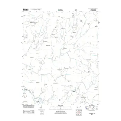
2011 Map of Tuckasegee
USGS Topo · Published 2011About this map
Cedar Cliff Lake and the Cedar Cliff Dam anchor the southwestern portion of this Jackson County landscape, where the Tuckasegee settlement serves as a primary point of reference. The terrain is defined by a dense network of high ridges and narrow gaps, including Buckeye Gap and Jackie Spring Gap, interspersed with family-named cemeteries that provide valuable points for genealogical research. Locations such as Stephenson Cemetery, Woodring Cemetery, and Queen Cemetery are scattered across the slopes of Rich Mountain and Coward Mountain.
Find a feature on this map
119 named features on this map. Tap any name to fly to it.
Don’t see what you’re looking for? This feature index may not catch every label — zoom into the map to look around manually.
Map Details
Editions of this 2011 Tuckasegee Map
This is the sole edition of this map. No revisions or reprints were ever made.
Other maps of this area

1891 · Cowee
USGS Topo · 1:125,000

1897 · Cowee
USGS Topo · 1:125,000

1905 · Pisgah
USGS Topo · 1:125,000

1906 · Pisgah
USGS Topo · 1:125,000

1907 · Cowee
USGS Topo · 1:125,000

1935 · Waynesville
USGS Topo · 1:24,000

1935 · Sam Knob
USGS Topo · 1:24,000

1935 · Tuckaseigee
USGS Topo · 1:24,000

1935 · Hazelwood
USGS Topo · 1:24,000

1935 · Lake Toxaway
USGS Topo · 1:24,000