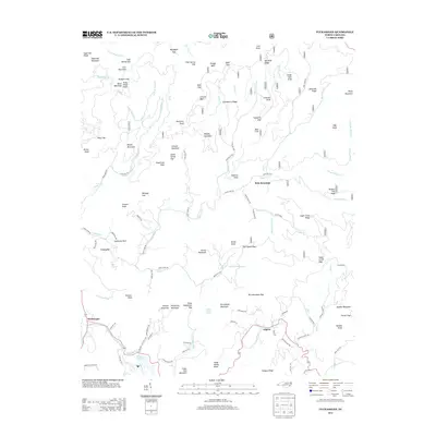
2013 Map of Tuckasegee
USGS Topo · Published 2013About this map
Tuckasegee and the winding Tuckasegee River anchor this mountain landscape, which is defined by a dense network of ridges, gaps, and family-named knobs. The settlement of Argura lies to the east, connected by winding mountain roads like Dodgen Ridge Rd, while the prehistoric Judaculla Rock stands as a significant landmark near Cowarts. The geography here is marked by steep elevation changes, moving from the waters of Cedar Cliff Lake to high peaks such as Brasstown Knob and Rich Mountain. Local hydrology is intricate, with numerous small waterways like Caney Fork and Sols Cr cutting through the terrain between points like Polly Middleton Gap and Sam Queen Gap. The map illustrates a contemporary rural mountain community where secondary state roads like State Rd 1748 and State Rd 1752 follow the contours of the land, linking isolated peaks and springs such as Cedar Valley Spring.
Find a feature on this map
128 named features on this map. Tap any name to fly to it.
Don’t see what you’re looking for? This feature index may not catch every label — zoom into the map to look around manually.
Map Details
Editions of this 2013 Tuckasegee Map
This is the sole edition of this map. No revisions or reprints were ever made.
Other maps of this area

1891 · Cowee
USGS Topo · 1:125,000

1897 · Cowee
USGS Topo · 1:125,000

1905 · Pisgah
USGS Topo · 1:125,000

1906 · Pisgah
USGS Topo · 1:125,000

1907 · Cowee
USGS Topo · 1:125,000

1935 · Waynesville
USGS Topo · 1:24,000

1935 · Sam Knob
USGS Topo · 1:24,000

1935 · Tuckaseigee
USGS Topo · 1:24,000

1935 · Hazelwood
USGS Topo · 1:24,000

1935 · Lake Toxaway
USGS Topo · 1:24,000