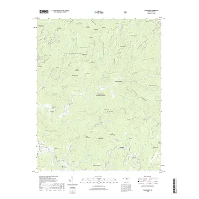
2019 Map of Tuckasegee
USGS Topo · Published 2019About this map
Nantahala National Forest encompasses the vast majority of this landscape in Jackson County, where high peaks like Rich Mountain and Snaggy Bald tower over narrow river valleys. The Tuckasegee River winds through the southern section, flanked by the settlement of Tuckasegee and a network of mountain roads such as Canada Rd. Small family-named communities and isolated homesteads are evidenced by numerous burial grounds including Woodring Cem, Stephenson Cem, and Brasstown Cem, many of which are situated on the slopes of ridges like Judaculla Ridge or Gooseberry Ridge. For hikers and local historians, the Mountains to Sea Trail traverses the northern boundary along the crest of the mountains. The terrain is defined by a dense drainage system where Moses Creek, Caney Fork, and Cedar Valley Cr create deep gaps and hollows, illustrating the classic settlement patterns of the Blue Ridge.
Find a feature on this map
107 named features on this map. Tap any name to fly to it.
Don’t see what you’re looking for? This feature index may not catch every label — zoom into the map to look around manually.
Map Details
Editions of this 2019 Tuckasegee Map
This is the sole edition of this map. No revisions or reprints were ever made.
Other maps of this area

1891 · Cowee
USGS Topo · 1:125,000

1897 · Cowee
USGS Topo · 1:125,000

1905 · Pisgah
USGS Topo · 1:125,000

1906 · Pisgah
USGS Topo · 1:125,000

1907 · Cowee
USGS Topo · 1:125,000

1935 · Waynesville
USGS Topo · 1:24,000

1935 · Sam Knob
USGS Topo · 1:24,000

1935 · Tuckaseigee
USGS Topo · 1:24,000

1935 · Hazelwood
USGS Topo · 1:24,000

1935 · Lake Toxaway
USGS Topo · 1:24,000