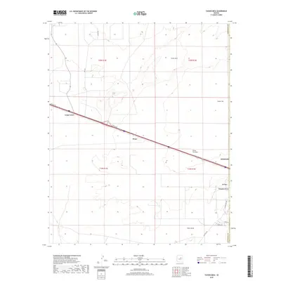
2018 Map of Tucker Mesa
USGS Topo · Published 2018About this map
Tucker Mesa dominates the northern landscape of this region west of Winslow, where the high desert meets the advancing infrastructure of the Interstate 40 corridor. The settlement pattern is defined by small clusters and highway junctions, most notably at Leupp Corner and the community of Moqui. As the terrain descends toward the Tucker Flat Wash, the map captures the transition from the open grazing lands of Tucker Flat to the more developed fringes of Winslow West and LeChee. The grid of the Public Land Survey System, including townships like t20n r14e, provides a structural framework for the sparse road network, which includes Hunt Rd and Wilburn Rd. Further south, the Toltec Divide serves as a subtle topographic marker in an area defined by wide vistas and intermittent drainage channels.
Find a feature on this map
21 named features on this map. Tap any name to fly to it.
Don’t see what you’re looking for? This feature index may not catch every label — zoom into the map to look around manually.
Map Details
Editions of this 2018 Tucker Mesa Map
This is the sole edition of this map. No revisions or reprints were ever made.
Other maps of this area

1883 · Tusayan
USGS Topo · 1:250,000

1886 · Tusayan
USGS Topo · 1:250,000

1886 · Holbrook
USGS Topo · 1:250,000

1893 · Holbrook
USGS Topo · 1:250,000

1947 · Flagstaff
USGS Topo · 1:250,000

1954 · Winslow
USGS Topo · 1:62,500

1954 · Winslow 4 NW
USGS Topo · 1:24,000

1954 · Winslow 4 SW
USGS Topo · 1:24,000

1954 · Flagstaff
USGS Topo · 1:250,000

1954 · Holbrook
USGS Topo · 1:250,000