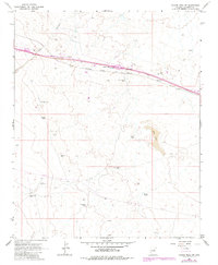
1968 Map of Tucker Mesa SW
USGS Topo · Published 1983About this map
The Atchison Topeka and Santa Fe railroad corridor dominates this high-desert landscape in Coconino County, serving as the primary transit artery through northern Arizona. Along this rail line, small settlements and stopping points like Meteor City and Dennison appear as vital nodes in an otherwise arid expanse. The terrain is defined by water management infrastructure essential for ranching and aviation, including Mud Lake, the Boulder Dam, and the Chilson Landing Strip. These features indicate a mid-century economy built around the intersection of large-scale transport and livestock management.
Find a feature on this map
24 named features on this map. Tap any name to fly to it.
Don’t see what you’re looking for? This feature index may not catch every label — zoom into the map to look around manually.
Map Details
Editions of this 1968 Tucker Mesa SW Map
2 editions found
Other maps of this area

1883 · Tusayan
USGS Topo · 1:250,000

1886 · Tusayan
USGS Topo · 1:250,000

1886 · San Francisco Mtns
USGS Topo · 1:250,000

1886 · Holbrook
USGS Topo · 1:250,000

1887 · Verde
USGS Topo · 1:250,000

1891 · San Francisco Mtns
USGS Topo · 1:250,000

1892 · Verde
USGS Topo · 1:250,000

1893 · Holbrook
USGS Topo · 1:250,000

1894 · San Francisco Mtns
USGS Topo · 1:250,000

1899 · San Francisco Mtns
USGS Topo · 1:250,000