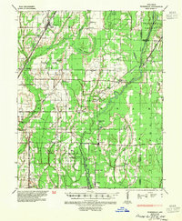
1935 Map of Tuckerman
USGS Topo · Published 1954About this map
Tuckerman and the surrounding Jackson County wetlands define this landscape during the mid-1930s, where the Cache River and its associated sloughs created a complex hydraulic environment. The transition from natural waterways like Tupelo Brake and Mink Slough to engineered drainage is evident through the presence of Willow Ditch and Meridian Ditch. This era shows a rural society organized around small hubs such as Amagon, Auvergne, and Grubbs, which were connected by the Missouri Pacific and St Louis - San Francisco railroads.
Find a feature on this map
74 named features on this map. Tap any name to fly to it.
Don’t see what you’re looking for? This feature index may not catch every label — zoom into the map to look around manually.
Map Details
Editions of this 1935 Tuckerman Map
2 editions found
Other maps of this area

1932 · Strawberry
USGS Topo · 1:62,500

1935 · Sedgwick
USGS Topo · 1:62,500

1935 · Alicia
USGS Topo · 1:62,500

1935 · Strawberry
USGS Topo · 1:62,500

1935 · Newport
USGS Topo · 1:62,500

1935 · Augusta
USGS Topo · 1:62,500

1935 · Tuckerman
USGS Topo · 1:62,500

1939 · Vanndale
USGS Topo · 1:62,500

1939 · Weiner
USGS Topo · 1:62,500

1940 · Tilton
USGS Topo · 1:62,500