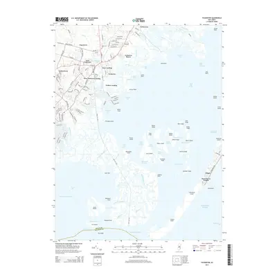
2014 Map of Tuckerton
USGS Topo · Published 2014About this map
Tuckerton and its neighboring coastal settlements are detailed here in a landscape defined by complex tidal marshlands and maritime history. The transition from established residential areas like Giffordtown and West Tuckerton into the vast networks of Little Egg Harbor and Tuckerton Bay reveals a coastline heavily influenced by water transport and aquaculture. One can trace the small channels and thoroughfares, such as Johnny Thorofare and Sloop Thorofare, which weave between numerous sedge islands including Hester Sedge and Middle Sedge.
Find a feature on this map
119 named features on this map. Tap any name to fly to it.
Don’t see what you’re looking for? This feature index may not catch every label — zoom into the map to look around manually.
Map Details
Editions of this 2014 Tuckerton Map
This is the sole edition of this map. No revisions or reprints were ever made.
Other maps of this area

1887 · Atlantic City
USGS Topo · 1:62,500

1888 · Little Egg Harbor
USGS Topo · 1:62,500

1888 · Long Beach
USGS Topo · 1:62,500

1893 · Little Egg Harbor
USGS Topo · 1:62,500

1893 · Long Beach
USGS Topo · 1:62,500

1894 · Atlantic City
USGS Topo · 1:62,500

1919 · Long Beach
USGS Topo · 1:62,500

1920 · Little Egg Harbor
USGS Topo · 1:62,500

1940 · Atlantic City
USGS Topo · 1:62,500
1941 · Atlantic City
USGS Topo · 1:62,500
Featured Places
- Galloway Township, NJ
- Little Egg Harbor Township, NJ
- Tuckerton, NJ
- Long Beach Township, NJ
- Eagleswood Township, NJ