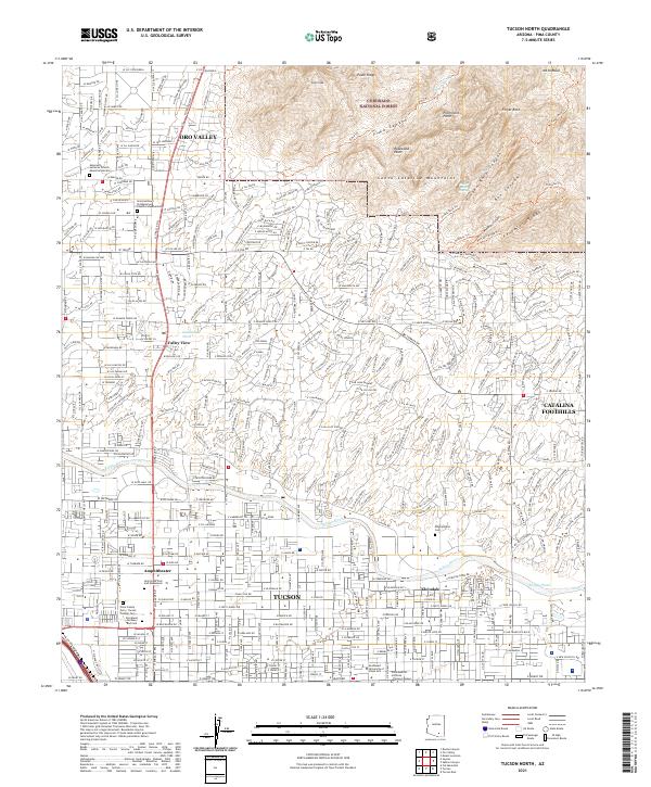
2021 Map of Tucson North
USGS Topo · Published 2021About this map
The northern reaches of Tucson meet the dramatic rise of the Santa Catalina Mountains in this modern topographic record. The map details the suburban expansion into the Catalina Foothills and the established communities of Oro Valley and Kleindale. For those researching local heritage, several significant burial grounds are noted, including the Pima County Cem / Tucson Pioneer Cem and the Binghampton Cem near the banks of the Rillito River. The transition from urban density to the protected wilderness of the Coronado National Forest is clearly defined, with trails like the Pima Trl and Finger-Rock Trl ascending toward landmarks such as Pusch Peak and Mt Kimball. The drainage patterns of the Pima Canyon and Geronimo Wash provide a clear view of how the desert landscape directs water from the high ridges down toward the valley floor.
Find a feature on this map
43 named features on this map. Tap any name to fly to it.
Don’t see what you’re looking for? This feature index may not catch every label — zoom into the map to look around manually.
Map Details
Editions of this 2021 Tucson North Map
This is the sole edition of this map. No revisions or reprints were ever made.
Other maps of this area

1904 · Tucson
USGS Topo · 1:125,000

1905 · Tucson
USGS Topo · 1:125,000

1925 · San Xavier
USGS Topo · 1:62,500

1934 · Tucson Mountains
USGS Topo · 1:125,000

1943 · San Xavier Mission
USGS Topo · 1:62,500

1947 · Cortaro
USGS Topo · 1:62,500

1948 · Tucson
USGS Topo · 1:62,500

1956 · Tucson
USGS Topo · 1:250,000

1957 · Tucson East
USGS Topo · 1:24,000

1957 · San Xavier Mission
USGS Topo · 1:62,500