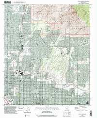
1996 Map of Tucson North
USGS Topo · Published 2002About this map
Casas Adobes and the northern outskirts of Tucson are captured here as suburban expansion meets the dramatic southern slopes of the Coronado National Forest. This 1990s record illustrates the dense residential grid pressing against the Pusch Ridge Wilderness, where sharp elevation gains lead to landmarks like Pusch Peak and Mt Kimball. The transition from urban development to protected peaks is stark, punctuated by the seasonal channels of the Rillito River and Santa Cruz R.
Find a feature on this map
62 named features on this map. Tap any name to fly to it.
Don’t see what you’re looking for? This feature index may not catch every label — zoom into the map to look around manually.
Map Details
Editions of this 1996 Tucson North Map
This is the sole edition of this map. No revisions or reprints were ever made.
Other maps of this area

1904 · Tucson
USGS Topo · 1:125,000

1905 · Tucson
USGS Topo · 1:125,000

1925 · San Xavier
USGS Topo · 1:62,500

1934 · Tucson Mountains
USGS Topo · 1:125,000

1943 · San Xavier Mission
USGS Topo · 1:62,500

1947 · Cortaro
USGS Topo · 1:62,500

1948 · Tucson
USGS Topo · 1:62,500

1956 · Tucson
USGS Topo · 1:250,000

1957 · Tucson East
USGS Topo · 1:24,000

1957 · San Xavier Mission
USGS Topo · 1:62,500