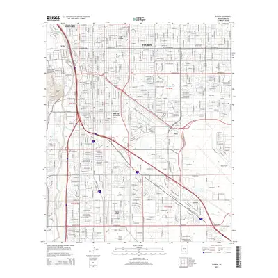
2014 Map of Tucson
USGS Topo · Published 2014About this map
The Santa Cruz River corridor anchors this 2014 view of Tucson, revealing a dense urban grid that transitions into industrial and military zones. To the west, the prominent Sentinel Peak overlooks the Santa Cruz Valley, while the north features the sprawling campus of the University of Arizona and Pima Community College. The map highlights distinct community enclaves such as the Pascua Yaqui Indian Village and the independent municipality of South Tucson, showcasing the area's unique cultural and political geography.
Find a feature on this map
47 named features on this map. Tap any name to fly to it.
Don’t see what you’re looking for? This feature index may not catch every label — zoom into the map to look around manually.
Map Details
Editions of this 2014 Tucson Map
This is the sole edition of this map. No revisions or reprints were ever made.
Other maps of this area

1904 · Tucson
USGS Topo · 1:125,000

1905 · Tucson
USGS Topo · 1:125,000

1925 · San Xavier
USGS Topo · 1:62,500

1934 · Tucson Mountains
USGS Topo · 1:125,000

1943 · San Xavier Mission
USGS Topo · 1:62,500

1947 · Cortaro
USGS Topo · 1:62,500

1948 · Tucson
USGS Topo · 1:62,500

1956 · Tucson
USGS Topo · 1:250,000

1957 · Tucson East
USGS Topo · 1:24,000

1957 · San Xavier Mission
USGS Topo · 1:62,500