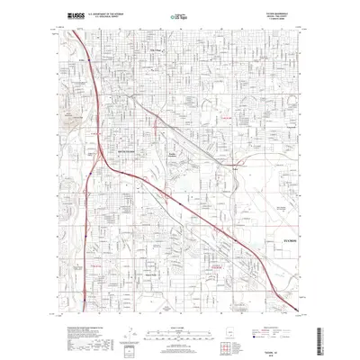
2018 Map of Tucson
USGS Topo · Published 2018About this map
University of Arizona and the surrounding urban grid of Pima County anchor this detailed 2018 record of the desert Southwest. The landscape is defined by the ephemeral courses of the Santa Cruz River and the Julian Wash, which channel seasonal water through a landscape of high-density housing, industrial zones, and institutional campuses. In the southwest, the Tucson International Airport stands as a massive logistical hub, while to the east, the sprawling Davis Monthan Air Force Base occupies a significant portion of the valley floor. Historically distinct neighborhoods like South Tucson, Pueblo Gardens, and Emery Park are shown alongside key landmarks such as Sentinel Peak in the Tucson Mountains. The map traces the modern transportation network, including the East Aviation Highway and East Benson Highway, reflecting the city's growth and its connection to the surrounding Sonoran Desert environment.
Find a feature on this map
32 named features on this map. Tap any name to fly to it.
Don’t see what you’re looking for? This feature index may not catch every label — zoom into the map to look around manually.
Map Details
Editions of this 2018 Tucson Map
This is the sole edition of this map. No revisions or reprints were ever made.
Other maps of this area

1904 · Tucson
USGS Topo · 1:125,000

1905 · Tucson
USGS Topo · 1:125,000

1925 · San Xavier
USGS Topo · 1:62,500

1934 · Tucson Mountains
USGS Topo · 1:125,000

1943 · San Xavier Mission
USGS Topo · 1:62,500

1947 · Cortaro
USGS Topo · 1:62,500

1948 · Tucson
USGS Topo · 1:62,500

1956 · Tucson
USGS Topo · 1:250,000

1957 · Tucson East
USGS Topo · 1:24,000

1957 · San Xavier Mission
USGS Topo · 1:62,500