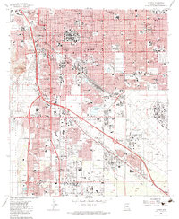
1983 Map of Tucson
USGS Topo · Published 1983About this map
The University of Arizona and the downtown core of Tucson anchor this mid-1980s landscape, illustrating a decade of significant urban expansion. The dense street grid, centered around major thoroughfares like Speedway and Broadway, gives way to the industrial and military presence of Davis-Monthan Air Force Base and the Southern Pacific rail lines. To the west, the distinctive profile of Sentinel Peak, also labeled A Mountain, stands over the Santa Cruz River, which serves as a geographic boundary for settlements like the Pascua Yaqui Indian Village.
Find a feature on this map
115 named features on this map. Tap any name to fly to it.
Don’t see what you’re looking for? This feature index may not catch every label — zoom into the map to look around manually.
Map Details
Editions of this 1983 Tucson Map
This is the sole edition of this map. No revisions or reprints were ever made.
Other maps of this area

1904 · Tucson
USGS Topo · 1:125,000

1905 · Tucson
USGS Topo · 1:125,000

1925 · San Xavier
USGS Topo · 1:62,500

1934 · Tucson Mountains
USGS Topo · 1:125,000

1943 · San Xavier Mission
USGS Topo · 1:62,500

1947 · Cortaro
USGS Topo · 1:62,500

1948 · Tucson
USGS Topo · 1:62,500

1956 · Tucson
USGS Topo · 1:250,000

1957 · Tucson East
USGS Topo · 1:24,000

1957 · San Xavier Mission
USGS Topo · 1:62,500