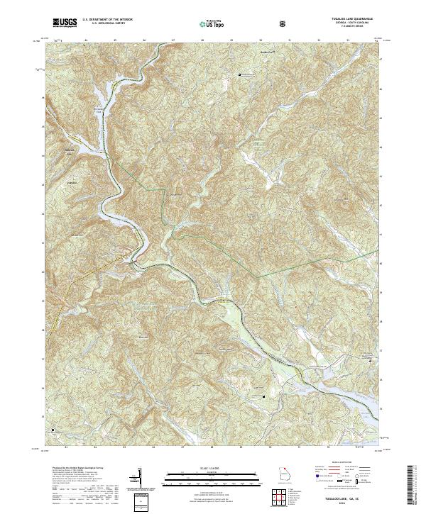
2024 Map of Tugaloo Lake
USGS Topo · Published 2024About this map
Tugaloo River defines the winding border between Georgia and South Carolina, cutting through a landscape dominated by the Chattahoochee National Forest and Sumter National Forest. This modern record of the area near Tugaloo shows the complex water systems of the Savannah River headwaters, including Tugaloo Lake, Yonah Lake, and the upper reaches of Hartwell Lake. The topography is shaped by dramatic elevations such as Boatwright Mtn and Abram Mtn, with Tallulah Falls marking a significant drop in the western portion of the quadrangle.
Find a feature on this map
112 named features on this map. Tap any name to fly to it.
Don’t see what you’re looking for? This feature index may not catch every label — zoom into the map to look around manually.
Map Details
Editions of this 2024 Tugaloo Lake Map
This is the sole edition of this map. No revisions or reprints were ever made.
Other maps of this area

1886 · Walhalla
USGS Topo · 1:125,000

1892 · Walhalla
USGS Topo · 1:125,000

1896 · Walhalla
USGS Topo · 1:125,000

1953 · Tallulah Falls
USGS Topo · 1:24,000

1954 · Greenville
USGS Topo · 1:250,000
1957 · Tiger
USGS Topo · 1:24,000

1957 · Tugaloo Lake
USGS Topo · 1:24,000
1957 · Rainy Mountain
USGS Topo · 1:24,000

1958 · Greenville
USGS Topo · 1:250,000
1961 · Whetstone
USGS Topo · 1:24,000