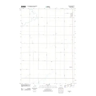
2012 Map of Tulare
USGS Topo · Published 2012About this map
Garfield Cem stands as a focal point in this agricultural landscape of Spink County, situated within a strictly gridded network of section-line roads. The terrain is defined by the winding course of Turtle Cr, which cuts across the western portion of the quadrangle, contrasting with the rigid north-south alignment of thoroughfares like 382nd Ave and 384th Ave. In the eastern section, the settlement of Spottswood and the northern outskirts of Tulare are positioned along the rail corridor, where Railway Ave runs parallel to the tracks. This layout illustrates a common Great Plains development pattern where small communities and burial grounds serve as the primary landmarks in a vast expanse of organized farmland.
Find a feature on this map
23 named features on this map. Tap any name to fly to it.
Don’t see what you’re looking for? This feature index may not catch every label — zoom into the map to look around manually.
Map Details
Editions of this 2012 Tulare Map
This is the sole edition of this map. No revisions or reprints were ever made.
Other maps of this area

1895 · Byron
USGS Topo · 1:125,000

1899 · Redfield
USGS Topo · 1:125,000

1953 · Huron
USGS Topo · 1:250,000

1954 · Huron
USGS Topo · 1:250,000

1966 · Redfield South
USGS Topo · 1:24,000

1966 · Redfield SW
USGS Topo · 1:24,000

1967 · Frankfort SW
USGS Topo · 1:24,000

1967 · Hitchcock SW
USGS Topo · 1:24,000

1967 · Tulare NW
USGS Topo · 1:24,000

1967 · Tulare SE
USGS Topo · 1:24,000