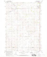
1967 Map of Tulare
USGS Topo · Published 1970About this map
Tulare serves as the primary hub on this central South Dakota landscape, situated along the line of the Chicago Milwaukee St Paul and Pacific railroad. The topography is defined by the winding course of Turtle Creek in the northwest and a network of water resources including a Flowing Well and numerous other wells that supported the region's agricultural vitality. This survey, conducted as part of the Department of the Interior program for the development of the Missouri River Basin, reveals a landscape of organized townships and counties, including Buffalo, Garfield, and Bonilla.
Find a feature on this map
16 named features on this map. Tap any name to fly to it.
Don’t see what you’re looking for? This feature index may not catch every label — zoom into the map to look around manually.
Map Details
Editions of this 1967 Tulare Map
This is the sole edition of this map. No revisions or reprints were ever made.
Other maps of this area

1895 · Byron
USGS Topo · 1:125,000

1899 · Redfield
USGS Topo · 1:125,000

1953 · Huron
USGS Topo · 1:250,000

1954 · Huron
USGS Topo · 1:250,000

1966 · Redfield South
USGS Topo · 1:24,000

1966 · Redfield SW
USGS Topo · 1:24,000

1967 · Frankfort SW
USGS Topo · 1:24,000

1967 · Hitchcock SW
USGS Topo · 1:24,000

1967 · Tulare NW
USGS Topo · 1:24,000

1967 · Tulare SE
USGS Topo · 1:24,000