
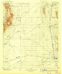
1916 Map of Tularosa
USGS Topo · Published 1916About this map
Tularosa serves as the primary gateway to a varied landscape of stark geological formations and remote ranching outposts in the years preceding the First World War. The region is defined by the expansive white gypsum of White Sands and the dark volcanic flows of The Malpais, bordered by the prominent Oscuro Mountains and the Godfrey Hills. Resource extraction and transport are central to the local economy, evidenced by the Mockingbird Gap Mine in the northwest and the El Paso and Southwestern railroad cutting a north-south path through the valley.
Find a feature on this map
50 named features on this map. Tap any name to fly to it.
Don’t see what you’re looking for? This feature index may not catch every label — zoom into the map to look around manually.
Map Details
Editions of this 1916 Tularosa Map
2 editions found
Other maps of this area

1916 · Tonuco
USGS Topo · 1:125,000

1916 · Salinas Peak
USGS Topo · 1:125,000

1916 · Point Of Sands
USGS Topo · 1:125,000

1918 · Oscura Peak
USGS Topo · 1:125,000

1932 · Tonuco
USGS Topo · 1:125,000

1938 · Carrizozo
USGS Topo · 1:48,000

1943 · Carrizozo
USGS Topo · 1:62,500

1947 · Point Of Sands 2
USGS Topo · 1:62,500

1947 · Three Rivers
USGS Topo · 1:62,500

1947 · Capitol Peak
USGS Topo · 1:62,500