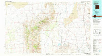
1981 Map of Tularosa
USGS Topo · Published 1981About this map
The San Andres Mountains dominate this 1981 landscape, a region defined by high-altitude ridges and deep drainage systems like Rhodes Canyon and Sulphur Canyon. To the east, the vast Tularosa Valley reveals a stark contrast, where the shifting White Sands and extensive Sand Dunes meet the wide Alkali Flat. This area represents a critical intersection of military operations and southwestern transportation, showing the sprawling footprint of the White Sands Missile Range alongside the historic Southern Pacific railroad corridor.
Find a feature on this map
40 named features on this map. Tap any name to fly to it.
Don’t see what you’re looking for? This feature index may not catch every label — zoom into the map to look around manually.
Map Details
Editions of this 1981 Tularosa Map
2 editions found

Other maps of this area

1916 · Tonuco
USGS Topo · 1:125,000

1916 · Salinas Peak
USGS Topo · 1:125,000

1916 · Tularosa
USGS Topo · 1:125,000

1916 · Point Of Sands
USGS Topo · 1:125,000

1918 · Oscura Peak
USGS Topo · 1:125,000

1932 · Tonuco
USGS Topo · 1:125,000

1938 · Carrizozo
USGS Topo · 1:48,000

1943 · Carrizozo
USGS Topo · 1:62,500

1947 · Point Of Sands 2
USGS Topo · 1:62,500

1947 · Three Rivers
USGS Topo · 1:62,500