
1981 Map of Tularosa
USGS Topo · Published 1981About this map
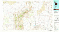
Tularosa sits at the eastern edge of a dramatic high-desert landscape where the San Andres Mountains and Chalk Hills rise sharply above the basin floor. This 1981 survey documents the extensive geography of the White Sands Missile Range, which dominates the central plains of the Tularosa Valley. The map details the complex natural hydrology and geology of the area, featuring the sprawling Alkali Flat, White Sands dune fields, and numerous drainage systems like Bitter Creek and Tularosa Creek that vanish into the arid basin.
Find a feature on this map
23 named features on this map. Tap any name to fly to it.
Don’t see what you’re looking for? This feature index may not catch every label — zoom into the map to look around manually.
Map Details
Editions of this 1981 Tularosa Map
2 editions found
Other maps of this area

1916 · Tonuco
USGS Topo · 1:125,000

1916 · Salinas Peak
USGS Topo · 1:125,000

1916 · Tularosa
USGS Topo · 1:125,000

1916 · Point Of Sands
USGS Topo · 1:125,000

1918 · Oscura Peak
USGS Topo · 1:125,000

1932 · Tonuco
USGS Topo · 1:125,000

1938 · Carrizozo
USGS Topo · 1:48,000

1943 · Carrizozo
USGS Topo · 1:62,500

1947 · Point Of Sands 2
USGS Topo · 1:62,500

1947 · Three Rivers
USGS Topo · 1:62,500