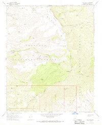
1967 Map of Tule Mesa
USGS Topo · Published 1968About this map
Pine Mountain and the Verde Rim dominate this high-desert landscape in the late 1960s, where the Prescott National Forest meets the Tonto National Forest. The map documents a rugged interior accessible primarily by a network of pack trails and jeep trails, reflecting a transition from traditional ranching to wilderness management. Cattle operations are evidenced by scattered improvements such as the Double T Ranch and MT Ranch, along with numerous water catchments like Tule Mountain Tank and Horse Pasture Tank. This network of tanks and springs, including Beehouse Spring and Black Alder Spring, reveals the critical infrastructure required for livestock survival in the Black Hills and Tule Mesa country before modern developments altered the region's land use.
Find a feature on this map
68 named features on this map. Tap any name to fly to it.
Don’t see what you’re looking for? This feature index may not catch every label — zoom into the map to look around manually.
Map Details
Editions of this 1967 Tule Mesa Map
2 editions found
Other maps of this area

1887 · Verde
USGS Topo · 1:250,000

1892 · Verde
USGS Topo · 1:250,000

1929 · Turret Peak
USGS Topo · 1:125,000

1933 · Turret Peak
USGS Topo · 1:125,000

1954 · Holbrook
USGS Topo · 1:250,000

1957 · Holbrook
USGS Topo · 1:250,000

1958 · Holbrook
USGS Topo · 1:250,000

1960 · Holbrook
USGS Topo · 1:250,000
1967 · Brooklyn Peak
USGS Topo · 1:24,000
1967 · Arnold Mesa
USGS Topo · 1:24,000