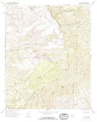
1967 Map of Tule Mesa
USGS Topo · Published 1968About this map
Prescott National Forest and Tonto National Forest meet in this high-desert landscape of central Arizona, defined by the towering Black Rim and Verde Rim. The 1967 survey reveals a remote network of ranching and water management, with isolated outposts like the Double T Ranch and Mt Ranch serving as focal points for local history.
Find a feature on this map
67 named features on this map. Tap any name to fly to it.
Don’t see what you’re looking for? This feature index may not catch every label — zoom into the map to look around manually.
Map Details
Editions of this 1967 Tule Mesa Map
2 editions found
Other maps of this area

1887 · Verde
USGS Topo · 1:250,000

1892 · Verde
USGS Topo · 1:250,000

1929 · Turret Peak
USGS Topo · 1:125,000

1933 · Turret Peak
USGS Topo · 1:125,000

1954 · Holbrook
USGS Topo · 1:250,000

1957 · Holbrook
USGS Topo · 1:250,000

1958 · Holbrook
USGS Topo · 1:250,000

1960 · Holbrook
USGS Topo · 1:250,000
1967 · Brooklyn Peak
USGS Topo · 1:24,000
1967 · Arnold Mesa
USGS Topo · 1:24,000