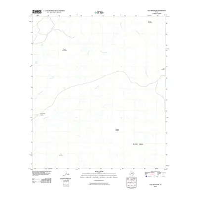
2010 Map of Tule Mountain
USGS Topo · Published 2010About this map
Tule Mountain and the expansive Burro Mesa dominate this West Texas landscape, defined by a complex network of arroyos and desert peaks. The area around Saint Helena Canyon Junction serves as a critical point for local navigation where Alamo Creek and Dawson Creek converge. Historically significant water sources in this arid environment, such as Bitter Spring and Indian Head Spring, appear tucked away near the slopes of Dogie Mountain.
Find a feature on this map
14 named features on this map. Tap any name to fly to it.
Don’t see what you’re looking for? This feature index may not catch every label — zoom into the map to look around manually.
Map Details
Editions of this 2010 Tule Mountain Map
This is the sole edition of this map. No revisions or reprints were ever made.
Other maps of this area

1903 · Chisos Mountains
USGS Topo · 1:125,000

1903 · Terlingua
USGS Topo · 1:125,000

1904 · Terlingua
USGS Topo · 1:125,000

1905 · Chisos Mountains
USGS Topo · 1:125,000

1959 · Emory Peak
USGS Topo · 1:250,000

1965 · Emory Peak
USGS Topo · 1:250,000

1971 · Terlingua
USGS Topo · 1:24,000

1971 · Cerro Castellan
USGS Topo · 1:24,000
1971 · Christmas Mountians
USGS Topo · 1:24,000
1971 · Hen Egg Mountain
USGS Topo · 1:24,000