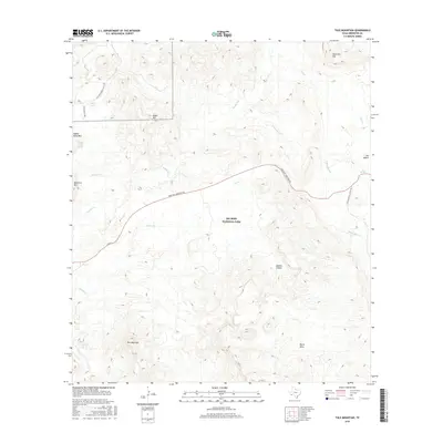
2016 Map of Tule Mountain
USGS Topo · Published 2016About this map
Big Bend National Park defines the vast majority of this landscape, where high desert elevations meet a network of ephemeral watercourses. The prominent landforms of Tule Mountain and the expansive Burro Mesa dominate the southern half of the quadrangle, illustrating the complex volcanic geology characteristic of the Trans-Pecos. Vital water sources for early ranching and travel are documented here, including Bitter Spring, Indian Head Spring, and Gano Springs, which appear as rare points of relief in a territory of dry washes like Rough Run and Alamo Cr.
Find a feature on this map
21 named features on this map. Tap any name to fly to it.
Don’t see what you’re looking for? This feature index may not catch every label — zoom into the map to look around manually.
Map Details
Editions of this 2016 Tule Mountain Map
This is the sole edition of this map. No revisions or reprints were ever made.
Other maps of this area

1903 · Chisos Mountains
USGS Topo · 1:125,000

1903 · Terlingua
USGS Topo · 1:125,000

1904 · Terlingua
USGS Topo · 1:125,000

1905 · Chisos Mountains
USGS Topo · 1:125,000

1959 · Emory Peak
USGS Topo · 1:250,000

1965 · Emory Peak
USGS Topo · 1:250,000

1971 · Terlingua
USGS Topo · 1:24,000

1971 · Cerro Castellan
USGS Topo · 1:24,000
1971 · Christmas Mountians
USGS Topo · 1:24,000
1971 · Hen Egg Mountain
USGS Topo · 1:24,000