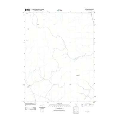
2011 Map of Tule Peak
USGS Topo · Published 2011About this map
Tule Peak and Tule Ridge dominate this high-desert landscape in northern Nevada, characterized by isolated water sources and dramatic landforms. The terrain is marked by seasonal drainages like Hardscrabble Creek and Mullen Creek, which carve through the Painted Hills and lead toward the wide expanse of the Winnemucca Valley. Human activity is sparse, concentrated along few corridors such as Winnemucca Ranch Rd and the winding Hardscrabble Canyon Rd. Local history and land use revolve around these scattered vital points, notably Kinnikinic Spring, Pradere Spring, and Cove Springs, which provided essential water in an arid environment. Distinctive landmarks like Needle Rock and Mahogany Flat serve as primary navigational anchors in the high-elevation backcountry of Paiute Canyon.
Find a feature on this map
15 named features on this map. Tap any name to fly to it.
Don’t see what you’re looking for? This feature index may not catch every label — zoom into the map to look around manually.
Map Details
Editions of this 2011 Tule Peak Map
This is the sole edition of this map. No revisions or reprints were ever made.
Other maps of this area

1886 · Granite Range
USGS Topo · 1:250,000

1891 · Reno
USGS Topo · 1:125,000

1893 · Reno
USGS Topo · 1:125,000

1894 · Granite Range
USGS Topo · 1:250,000

1955 · Lovelock
USGS Topo · 1:250,000

1957 · Sutcliffe
USGS Topo · 1:62,500

1957 · Dogskin Mountain
USGS Topo · 1:62,500

1957 · Reno
USGS Topo · 1:250,000

1959 · Lovelock
USGS Topo · 1:250,000

1959 · Reno
USGS Topo · 1:250,000