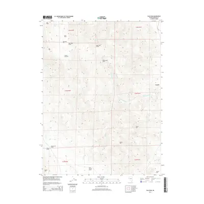
2014 Map of Tule Peak
USGS Topo · Published 2014About this map
The Virginia Mountains dominate this high-desert landscape in northern Washoe County, where the topography transitions from the dramatic elevation of Tule Peak down toward the Great Basin basins. This 2014 survey captures a region defined by its complex drainage systems and varied terrain, including the steep-walled Hardscrabble Cañon and the expansive Painted Hills. The settlement of Sutcliffe appears on the eastern edge of the quadrangle, serving as a gateway to the surrounding valleys. High-altitude features like Mahogany Flat and Little Valley are interspersed with seasonal water sources such as Mud Spring and Kinnikinic Spring, which historically supported ranching and transit through the area. To the south, the terrain levels into the Winnemucca Valley and Warm Springs Valley, separated by the distinct rise of Dogskin Mtn and the natural corridor of Mullen Pass.
Find a feature on this map
28 named features on this map. Tap any name to fly to it.
Don’t see what you’re looking for? This feature index may not catch every label — zoom into the map to look around manually.
Map Details
Editions of this 2014 Tule Peak Map
This is the sole edition of this map. No revisions or reprints were ever made.
Other maps of this area

1886 · Granite Range
USGS Topo · 1:250,000

1891 · Reno
USGS Topo · 1:125,000

1893 · Reno
USGS Topo · 1:125,000

1894 · Granite Range
USGS Topo · 1:250,000

1955 · Lovelock
USGS Topo · 1:250,000

1957 · Sutcliffe
USGS Topo · 1:62,500

1957 · Dogskin Mountain
USGS Topo · 1:62,500

1957 · Reno
USGS Topo · 1:250,000

1959 · Lovelock
USGS Topo · 1:250,000

1959 · Reno
USGS Topo · 1:250,000