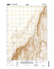
2014 Map of Tule Springs
USGS Topo · Published 2014About this map
The Alvord Desert floor and the rising elevations of the Tule Springs Rims dominate this section of Harney County. This 2014 survey captures a landscape defined by critical water sources in an arid environment, including Big Sand Gap Spring, Sailor Jack Spring, and the namesake Tule Springs. These points of reliable water historically dictated the movements of people and livestock through the High Desert. The terrain transitions from the flat desert expanse in the north to the more complex topography of the south and east, where Howluk Butte and various geological features like Big Sand Gap and Little Sand Gap provide distinctive landmarks for navigation across the open basin and range country.
Find a feature on this map
12 named features on this map. Tap any name to fly to it.
Don’t see what you’re looking for? This feature index may not catch every label — zoom into the map to look around manually.
Map Details
Editions of this 2014 Tule Springs Map
This is the sole edition of this map. No revisions or reprints were ever made.
Other maps of this area

1955 · Adel
USGS Topo · 1:250,000

1957 · Adel
USGS Topo · 1:250,000

1958 · Adel
USGS Topo · 1:250,000

1962 · Adel
USGS Topo · 1:250,000

1968 · Alvord Hot Springs
USGS Topo · 1:24,000

1971 · Andrews
USGS Topo · 1:24,000

1971 · Borax Lake
USGS Topo · 1:24,000

1981 · Tule Springs
USGS Topo · 1:24,000

1981 · Tule Springs NE
USGS Topo · 1:24,000

1981 · Miranda Flat SW
USGS Topo · 1:24,000