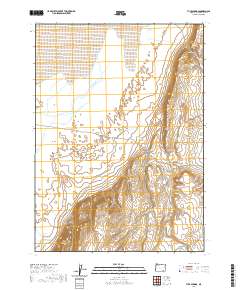
2020 Map of Tule Springs
USGS Topo · Published 2020About this map
Alvord Desert occupies the northern reaches of this High Desert landscape, where the flat, arid basin meets the dramatic elevation of the Steens Mountain foothills. The terrain is defined by sharp vertical relief, notably at the Tule Springs Rims and the prominent Howluk Butte to the southeast. Water sources are critical but sparse markers in this environment, including the namesake Tule Springs and the interestingly named Sailor Jack Spring. Natural passages through the ridgelines are identified at Big Sand Gap and Little Sand Gap, indicating the traditional routes used to navigate this corner of Harney County. The survey illustrates a stark geography where life centers on these rare water points and the geological transitions between the dry lake bed and the surrounding volcanic uplands.
Find a feature on this map
12 named features on this map. Tap any name to fly to it.
Don’t see what you’re looking for? This feature index may not catch every label — zoom into the map to look around manually.
Map Details
Editions of this 2020 Tule Springs Map
This is the sole edition of this map. No revisions or reprints were ever made.
Other maps of this area

1955 · Adel
USGS Topo · 1:250,000

1957 · Adel
USGS Topo · 1:250,000

1958 · Adel
USGS Topo · 1:250,000

1962 · Adel
USGS Topo · 1:250,000

1968 · Alvord Hot Springs
USGS Topo · 1:24,000

1971 · Andrews
USGS Topo · 1:24,000

1971 · Borax Lake
USGS Topo · 1:24,000

1981 · Tule Springs
USGS Topo · 1:24,000

1981 · Tule Springs NE
USGS Topo · 1:24,000

1981 · Miranda Flat SW
USGS Topo · 1:24,000