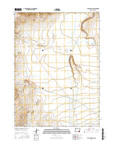
2017 Map of Tule Springs NE
USGS Topo · Published 2017About this map
Willow Creek meanders through this remote portion of Harney County, defining the hydrologic character of the high desert landscape. This 2017 study by the U.S. Geological Survey details the intricate topography of the region, where the terrain is marked by seasonal wetlands and the distinct boundaries of t35s r35e, t35s r36e, t36s r35e, and t36s r36e. The drainage patterns and elevation contours reveal a quiet, unpopulated expanse, preserving the natural state of the Oregon interior as it appeared in the early 21st century.
Find a feature on this map
5 named features on this map. Tap any name to fly to it.
Don’t see what you’re looking for? This feature index may not catch every label — zoom into the map to look around manually.
Map Details
Editions of this 2017 Tule Springs NE Map
This is the sole edition of this map. No revisions or reprints were ever made.
Other maps of this area

1955 · Adel
USGS Topo · 1:250,000

1957 · Adel
USGS Topo · 1:250,000

1958 · Adel
USGS Topo · 1:250,000

1962 · Adel
USGS Topo · 1:250,000

1981 · Coyote Lake West
USGS Topo · 1:24,000

1981 · Tule Springs
USGS Topo · 1:24,000

1981 · Tule Springs NE
USGS Topo · 1:24,000

1981 · Miranda Flat SW
USGS Topo · 1:24,000

1981 · Miranda Flat SE
USGS Topo · 1:24,000
1981 · Red Mountain
USGS Topo · 1:24,000