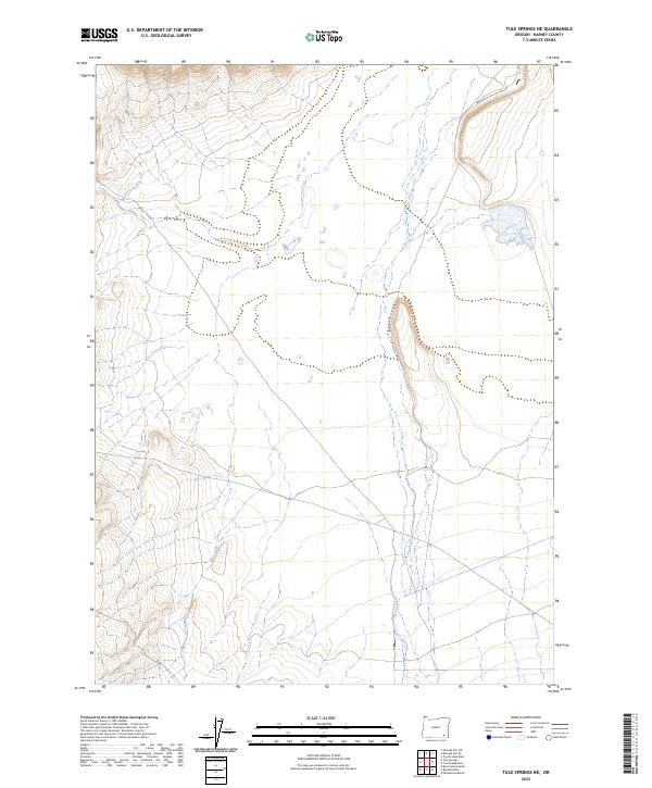
2023 Map of Tule Springs NE
USGS Topo · Published 2023About this map
Willow Creek meanders through this portion of Harney County, providing a vital source of water in an arid high-desert landscape defined by the Public Land Survey System grids of t35s r35e, t35s r36e, t36s r35e, and t36s r36e. The drainage pattern of the creek reveals how the seasonal flow of water shapes the local topography, carving paths through the basin between rising landforms. This 2023 survey by the U.S. Geological Survey reflects a landscape primarily characterized by its lack of permanent settlements, focused instead on the natural hydrography and the geometric township and range boundaries that have governed Oregon land management for generations.
Find a feature on this map
5 named features on this map. Tap any name to fly to it.
Don’t see what you’re looking for? This feature index may not catch every label — zoom into the map to look around manually.
Map Details
Editions of this 2023 Tule Springs NE Map
This is the sole edition of this map. No revisions or reprints were ever made.
Other maps of this area

1955 · Adel
USGS Topo · 1:250,000

1957 · Adel
USGS Topo · 1:250,000

1958 · Adel
USGS Topo · 1:250,000

1962 · Adel
USGS Topo · 1:250,000

1981 · Coyote Lake West
USGS Topo · 1:24,000

1981 · Tule Springs
USGS Topo · 1:24,000

1981 · Tule Springs NE
USGS Topo · 1:24,000

1981 · Miranda Flat SW
USGS Topo · 1:24,000

1981 · Miranda Flat SE
USGS Topo · 1:24,000
1981 · Red Mountain
USGS Topo · 1:24,000