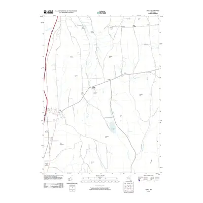
2010 Map of Tully
USGS Topo · Published 2010About this map
Tully and its nearby settlements like Apulia and Collingwood characterize this part of Onondaga County during the early 21st century. The landscape is defined by its deep hollows and prominent hills, including Labrador Hill and The Pinnacle, which create a complex drainage system feeding into water bodies such as Labrador Pond and Butternut Creek. Of particular interest to local historians are the numerous small burial grounds and family plots that dot the terrain, from the Farr Burying Ground near the western edge to the Miles-Mighells Cemetery situated between high ridges. The presence of the Thermal Ridge Gliderport near the southern boundary highlights the area's continued use of its significant elevation changes for recreation. The road network, including historic routes like Old Rte 80 and Truxton Rd, connects the scattered hamlets of Jerome Corners, Berwyn, and Swift Corner, tracing the paths of earlier valley settlements.
Find a feature on this map
71 named features on this map. Tap any name to fly to it.
Don’t see what you’re looking for? This feature index may not catch every label — zoom into the map to look around manually.
Map Details
Editions of this 2010 Tully Map
This is the sole edition of this map. No revisions or reprints were ever made.
Other maps of this area

1897 · Cazenovia
USGS Topo · 1:62,500

1899 · Cazenovia
USGS Topo · 1:62,500

1900 · Tully
USGS Topo · 1:62,500

1903 · Cortland
USGS Topo · 1:62,500

1904 · Pitcher
USGS Topo · 1:62,500

1942 · Oran
USGS Topo · 1:24,000

1943 · South Onondaga
USGS Topo · 1:31,680

1943 · Jamesville
USGS Topo · 1:31,680

1943 · Otisco Valley
USGS Topo · 1:31,680
1943 · Oran
USGS Topo · 1:31,680