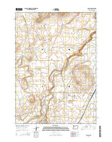
2014 Map of Tumalo
USGS Topo · Published 2014About this map
The Deschutes River carves a deep path through this high desert terrain, serving as the central axis for irrigation and settlement patterns in the early 21st century. The unincorporated community of Tumalo sits near the base of Laidlaw Butte, reflecting its origins as a hub for local agriculture and commerce. Traces of historical land use are evident in the extensive network of waterways like the Tumalo Feed Canal and Swalley Canal, which redirect river water to the surrounding arid plains. Higher elevations are marked by distinctive volcanic features including Cline Buttes and Long Butte, while the local heritage is anchored at the Tumalo Cem. The road network, including the Old Bend Redmond Hwy, illustrates the transition from rural market routes to modern regional connectors.
Find a feature on this map
73 named features on this map. Tap any name to fly to it.
Don’t see what you’re looking for? This feature index may not catch every label — zoom into the map to look around manually.
Map Details
Editions of this 2014 Tumalo Map
This is the sole edition of this map. No revisions or reprints were ever made.
Other maps of this area

1926 · Bend
USGS Topo · 1:125,000

1929 · Bend
USGS Topo · 1:125,000

1955 · Bend
USGS Topo · 1:250,000

1957 · Bend
USGS Topo · 1:250,000

1958 · Bend
USGS Topo · 1:250,000

1961 · Redmond
USGS Topo · 1:24,000

1962 · Forked Horn Butte
USGS Topo · 1:24,000
1962 · Bend
USGS Topo · 1:24,000
1962 · Bend Airport
USGS Topo · 1:24,000
1962 · Redmond
USGS Topo · 1:24,000