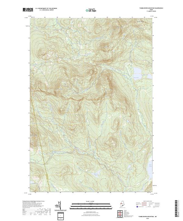
2024 Map of Tumbledown Mountain
USGS Topo · Published 2024About this map
The Somerset and Franklin County line divides this interior Maine landscape, a region defined by high peaks and an intricate network of drainage basins. Rising significantly above the surrounding terrain, Tumbledown Mtn and Three Slide Mtn anchor the central portion of the sheet. The hydrology is dominated by the Spencer Stream system, including the West Branch Spencer Stream, which collects water from numerous brooks such as Durgin Brook and Gold Brook. While the area is largely characterized by its natural features, human access is marked by several remote routes including Appleton Rd and Spencer Bale Rd. Several bodies of water, such as Blakeslee Lake and Baker Pond, suggest the type of secluded locations prized by generations of sportsmen and wood-lot managers in this part of the state.
Find a feature on this map
31 named features on this map. Tap any name to fly to it.
Don’t see what you’re looking for? This feature index may not catch every label — zoom into the map to look around manually.
Map Details
Editions of this 2024 Tumbledown Mountain Map
This is the sole edition of this map. No revisions or reprints were ever made.
Other maps of this area

1923 · Attean
USGS Topo · 1:62,500

1925 · Attean
USGS Topo · 1:62,500

1928 · Chain Lakes
USGS Topo · 1:48,000

1928 · Skinner
USGS Topo · 1:48,000

1928 · Spencer
USGS Topo · 1:48,000

1931 · Skinner
USGS Topo · 1:62,500

1932 · Spencer
USGS Topo · 1:62,500

1932 · Chain Lakes
USGS Topo · 1:62,500

1935 · Chain Lakes
USGS Topo · 1:62,500

1949 · Jackman
USGS Topo · 1:250,000
Featured Places
- Rayton Township, ME
- Hobbstown Township, ME
- Appleton Township, ME
- Haynestown Township, ME
- King & Bartlett Township, ME