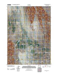
2011 Map of Tumtum Lake
USGS Topo · Published 2011About this map
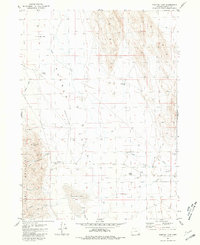
Tumtum Lake sits at the southern reach of this arid basin in Harney County, illustrating the remote ranching landscape of the Great Basin at the start of the 21st century. The map depicts a network of seasonal watercourses and drainage patterns, including Catlow Creek and the long course of Trout Creek, which flows past several isolated family holdings. These operations, such as Outerkirk Ranch, Sherburn Ranch, and Trout Creek Ranch, are connected by a sparse road system featuring Whitehorse Ranch Rd and Old Trout Creek Rd. The terrain transitions from the floor of the Alvord Valley toward the rising slopes of the White Horse Mountains in the northeast, while the prominent Snake Den Butte stands as a distinct landmark in the west. This survey provides a precise record of land use and water management in a region where cattle ranching remains the primary human footprint.
Find a feature on this map
15 named features on this map. Tap any name to fly to it.
Don’t see what you’re looking for? This feature index may not catch every label — zoom into the map to look around manually.
Map Details
Editions of this 2011 Tumtum Lake Map
This is the sole edition of this map. No revisions or reprints were ever made.
Other maps of this area

1955 · Adel
USGS Topo · 1:250,000

1957 · Adel
USGS Topo · 1:250,000

1958 · Adel
USGS Topo · 1:250,000

1962 · Adel
USGS Topo · 1:250,000

1971 · Fields
USGS Topo · 1:24,000

1971 · Borax Lake
USGS Topo · 1:24,000
1980 · Windy Point
USGS Topo · 1:24,000
1981 · Colony Ranch
USGS Topo · 1:24,000
1981 · Van Horn Basin
USGS Topo · 1:24,000
1981 · Tumtum Lake
USGS Topo · 1:24,000