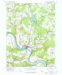
1946 Map of Tunkhannock
USGS Topo · Published 1977About this map
The Susquehanna River bends sharply through Wyoming County on this mid-century survey, anchoring the borough of Tunkhannock. This period reveals a landscape transitioning between its agricultural roots and modern aviation, as evidenced by the Skyhaven Landing Field and an Airway Beacon on Osterhout Mountain. The river's path is closely followed by the Lehigh Valley railroad and the Roosevelt Highway, which served as the primary arteries for local industry and transport during the post-war era.
Find a feature on this map
73 named features on this map. Tap any name to fly to it.
Don’t see what you’re looking for? This feature index may not catch every label — zoom into the map to look around manually.
Map Details
Editions of this 1946 Tunkhannock Map
Other maps of this area

1891 · Harveys Lake
USGS Topo · 1:62,500

1893 · Harvey Lake
USGS Topo · 1:62,500

1893 · Pittston
USGS Topo · 1:62,500

1943 · Scranton
USGS Topo · 1:125,000

1945 · Meshoppen
USGS Topo · 1:62,500

1945 · Auburn Center
USGS Topo · 1:24,000

1945 · Meshoppen
USGS Topo · 1:24,000

1946 · Tunkhannock
USGS Topo · 1:62,500

1946 · Noxen
USGS Topo · 1:24,000

1946 · Ransom
USGS Topo · 1:24,000
Featured Places
- Falls Township, PA
- Tunkhannock, PA
- Lemon Township, PA
- Brookside, Tunkhannock Township
- Marcy, Tunkhannock Township