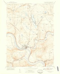
1948 Map of Tunkhannock
USGS Topo · Published 1948About this map
Tunkhannock serves as the central hub of this Wyoming County landscape, situated along a prominent bend in the Susquehanna River. In the late 1940s, the area's infrastructure was defined by the Lehigh Valley railroad and the Roosevelt Highway, which supported small communities like Eatonville and Lake Carey. The terrain is marked by significant elevations such as Osterhout Mountain and Miller Mtn, while the river valley contains vital transit and aviation markers like the Airway Beacon and Skyhaven Landing Field. Local life is further documented through numerous landmarks including Sunnyside Cemetery, Eatonville School, and rural post offices like Osterhout PO. The map captures a moment when small railroad stations such as La Grange Station still linked these river settlements to the wider region, and recreational spots like St Andrews Camp and the waters of Oxbow Lake provided community focal points.
Find a feature on this map
78 named features on this map. Tap any name to fly to it.
Don’t see what you’re looking for? This feature index may not catch every label — zoom into the map to look around manually.
Map Details
Editions of this 1948 Tunkhannock Map
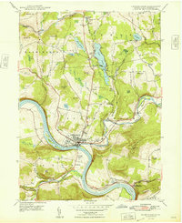
2 editions found
Other maps of this area

1891 · Harveys Lake
USGS Topo · 1:62,500

1893 · Harvey Lake
USGS Topo · 1:62,500

1893 · Pittston
USGS Topo · 1:62,500

1943 · Scranton
USGS Topo · 1:125,000

1945 · Meshoppen
USGS Topo · 1:62,500

1945 · Auburn Center
USGS Topo · 1:24,000

1945 · Meshoppen
USGS Topo · 1:24,000

1946 · Tunkhannock
USGS Topo · 1:62,500

1946 · Noxen
USGS Topo · 1:24,000

1946 · Ransom
USGS Topo · 1:24,000
Featured Places
- Falls Township, PA
- Tunkhannock, PA
- Lemon Township, PA
- Brookside, Tunkhannock Township
- Marcy, Tunkhannock Township