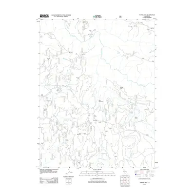
2012 Map of Tunnel Hill
USGS Topo · Published 2012About this map
Quintette sits at the heart of this landscape, surrounded by a complex network of seasonal camps and ranching outposts in the foothills. The terrain is defined by dramatic elevation changes, with Bald Mountain and the Sugarloaf rising above deep drainages like Mutton Canyon and Bacon Canyon. The northern reaches are shaped by the Rubicon River, while various springs like Zero Spring and Dad Youngs Spring indicate the importance of water management in this environment.
Find a feature on this map
61 named features on this map. Tap any name to fly to it.
Don’t see what you’re looking for? This feature index may not catch every label — zoom into the map to look around manually.
Map Details
Editions of this 2012 Tunnel Hill Map
This is the sole edition of this map. No revisions or reprints were ever made.
Other maps of this area

1891 · Colfax
USGS Topo · 1:125,000

1891 · Placerville
USGS Topo · 1:125,000

1892 · Placerville
USGS Topo · 1:125,000

1892 · Colfax
USGS Topo · 1:125,000

1893 · Placerville
USGS Topo · 1:125,000

1894 · Colfax
USGS Topo · 1:125,000

1898 · Colfax
USGS Topo · 1:125,000

1900 · Colfax
USGS Topo · 1:125,000

1902 · Colfax
USGS Topo · 1:125,000

1938 · Colfax
USGS Topo · 1:125,000