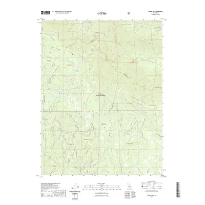
2021 Map of Tunnel Hill
USGS Topo · Published 2021About this map
Eldorado National Forest defines the character of this landscape along the border of El Dorado and Placer counties. The small settlement of Quintette serves as a focal point in a region dominated by steep drainage systems and high ridges. The map meticulously traces the course of the Rubicon River and its numerous tributaries, including Pilot Creek and Rock Creek, which have carved deep canyons like Missouri Canyon and Bacon Canyon through the timbered terrain.
Find a feature on this map
60 named features on this map. Tap any name to fly to it.
Don’t see what you’re looking for? This feature index may not catch every label — zoom into the map to look around manually.
Map Details
Editions of this 2021 Tunnel Hill Map
This is the sole edition of this map. No revisions or reprints were ever made.
Other maps of this area

1891 · Colfax
USGS Topo · 1:125,000

1891 · Placerville
USGS Topo · 1:125,000

1892 · Placerville
USGS Topo · 1:125,000

1892 · Colfax
USGS Topo · 1:125,000

1893 · Placerville
USGS Topo · 1:125,000

1894 · Colfax
USGS Topo · 1:125,000

1898 · Colfax
USGS Topo · 1:125,000

1900 · Colfax
USGS Topo · 1:125,000

1902 · Colfax
USGS Topo · 1:125,000

1938 · Colfax
USGS Topo · 1:125,000