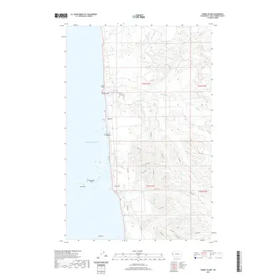
2020 Map of Tunnel Island
USGS Topo · Published 2020About this map
The coastal edge of the Quinault Reservation meets the Pacific Ocean in this survey of a remote stretch of Washington's Olympic Peninsula. The coastline is defined by distinctive maritime landmarks such as Tunnel Island, Elephant Rock, and the sea stacks of Willoughby Rock and Split Rock. Moving inland, the landscape is heavily dissected by an intricate drainage system including the Raft River and its primary tributary, the N Fork Raft River, alongside smaller streams like Rainy Cr and Red Cr.
Find a feature on this map
38 named features on this map. Tap any name to fly to it.
Don’t see what you’re looking for? This feature index may not catch every label — zoom into the map to look around manually.
Map Details
Editions of this 2020 Tunnel Island Map
This is the sole edition of this map. No revisions or reprints were ever made.
Other maps of this area

1943 · Copalis Beach
USGS Topo · 1:250,000

1951 · Copalis Beach
USGS Topo · 1:250,000

1955 · Taholah
USGS Topo · 1:62,500

1955 · Macafee Hill
USGS Topo · 1:62,500

1956 · Destruction Island
USGS Topo · 1:62,500

1956 · Salmon River
USGS Topo · 1:62,500

1957 · Copalis Beach
USGS Topo · 1:250,000

1963 · Copalis Beach
USGS Topo · 1:250,000
1980 · Copalis Beach
USGS Topo · 1:100,000
1982 · Taholah
USGS Topo · 1:24,000