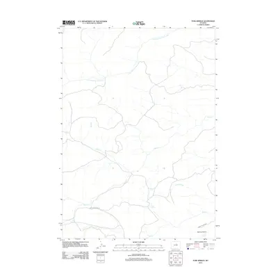
2012 Map of Turk Springs
USGS Topo · Published 2012About this map
S Fork Red Fork Powder River flows through this corner of Washakie County, defining a landscape shaped by significant water sources and upland grazing. The presence of Turk Springs, Carr Spring, and Rowan Spring indicates the critical importance of reliable water in this part of Wyoming, supporting the pastoral economy evident at Bachaus Pasture. Transportation through the area is limited to rural routes like Barnum Mountain Rd and Bachus Pasture Rd, which trace the drainage patterns of Beaver Cr and Blue Cr. This survey illustrates the remote character of the region, where named landmarks are primarily natural features or related to the long-standing ranching traditions of the Powder River basin.
Find a feature on this map
11 named features on this map. Tap any name to fly to it.
Don’t see what you’re looking for? This feature index may not catch every label — zoom into the map to look around manually.
Map Details
Editions of this 2012 Turk Springs Map
This is the sole edition of this map. No revisions or reprints were ever made.
Other maps of this area

1955 · Arminto
USGS Topo · 1:250,000

1958 · Arminto
USGS Topo · 1:250,000

1961 · Barnum
USGS Topo · 1:62,500

1962 · Arminto
USGS Topo · 1:250,000

1963 · Mayoworth
USGS Topo · 1:62,500
1966 · Tallon Spring
USGS Topo · 1:24,000
1967 · Tabletop
USGS Topo · 1:24,000

1967 · Horse Butte
USGS Topo · 1:24,000

1967 · Gordon Creek
USGS Topo · 1:24,000

1967 · Turk Springs
USGS Topo · 1:24,000