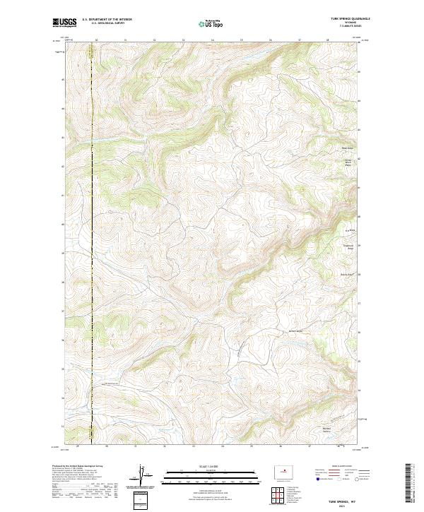
2021 Map of Turk Springs
USGS Topo · Published 2021About this map
S Fork Red Fork Powder River flows through the northern reaches of this high-country landscape along the Washakie Co Johnson Co boundary. The terrain is defined by a series of distinct ridges and drainages that shaped early movement through the region, including Telephone Ridge, Poison Weed Ridge, and Robins Ridge. Settlement traces are sparse, centered on seasonal grazing lands like Bachaus Pasture and isolated water sources such as Rowan Spring and Carr Spring. Local transit is represented by limited vehicle paths like Barnum Mountain Rd and Bachus Pasture Rd, which connect the high plateaus and steep breaks of Devoe Canyon. This 2021 update documents the enduring ranching character and complex topography of the Bighorn Mountains' eastern slopes, where water features like Beaver Cr and Turk Springs remain vital landmarks.
Find a feature on this map
24 named features on this map. Tap any name to fly to it.
Don’t see what you’re looking for? This feature index may not catch every label — zoom into the map to look around manually.
Map Details
Editions of this 2021 Turk Springs Map
This is the sole edition of this map. No revisions or reprints were ever made.
Other maps of this area

1955 · Arminto
USGS Topo · 1:250,000

1958 · Arminto
USGS Topo · 1:250,000

1961 · Barnum
USGS Topo · 1:62,500

1962 · Arminto
USGS Topo · 1:250,000

1963 · Mayoworth
USGS Topo · 1:62,500
1966 · Tallon Spring
USGS Topo · 1:24,000
1967 · Tabletop
USGS Topo · 1:24,000

1967 · Horse Butte
USGS Topo · 1:24,000

1967 · Gordon Creek
USGS Topo · 1:24,000

1967 · Turk Springs
USGS Topo · 1:24,000