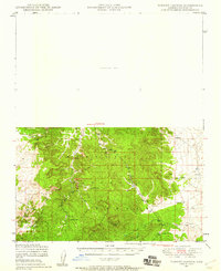
1947 Map of Turkey Canyon
USGS Topo · Published 1959About this map
The Prescott National Forest dominates this landscape in Yavapai County, where steep terrain and water management define the settlement patterns. Much of the northern half is marked as an Unsurveyed Area, reflecting the challenging topography of the mid-century Southwest. In the more developed southern sections, seasonal or high-country outposts like Happy Camp and Lower Corrals appear alongside water infrastructure such as Hutch Tank and Section 10 Tank. The presence of the Luis Maria Baca Float No 5 boundary indicates the lasting influence of 19th-century Spanish land grants on Arizona's land distribution. Natural water sources like Turkey Creek and Pine Creek carve through the elevation, while signs of early resource extraction are visible at Iron Well.
Find a feature on this map
13 named features on this map. Tap any name to fly to it.
Don’t see what you’re looking for? This feature index may not catch every label — zoom into the map to look around manually.
Map Details
Editions of this 1947 Turkey Canyon Map
2 editions found

Other maps of this area

1886 · Diamond Creek
USGS Topo · 1:250,000

1886 · Chino
USGS Topo · 1:250,000

1887 · Prescott
USGS Topo · 1:250,000

1891 · Chino
USGS Topo · 1:250,000

1892 · Diamond Creek
USGS Topo · 1:250,000

1892 · Prescott
USGS Topo · 1:250,000

1923 · Signal
USGS Topo · 1:250,000

1942 · Signal
USGS Topo · 1:250,000

1947 · Simmons
USGS Topo · 1:62,500

1947 · Picacho Butte
USGS Topo · 1:62,500