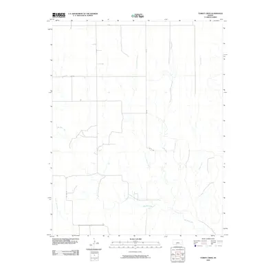
2009 Map of Turkey Creek
USGS Topo · Published 2009About this map
Turkey Creek and its tributary, Little Turkey Creek, drain this rural expanse in Kiowa County, where the landscape is defined by the dendritic patterns of high plains drainage. The hydrology of the area is further marked by the presence of West Kiowa Creek and Sand Creek, carving subtle paths through the terrain. Human presence is etched onto the land in a strict sectional grid, with arterial routes like Old Hwy 34 and Zane Rd providing the primary framework for movement. The map captures a moment in the early 21st century where the traditional rural infrastructure remains, represented by gravel roads such as Co Rd 136 and 134 Rd, which facilitate the agriculture and ranching interests characteristic of the region.
Find a feature on this map
12 named features on this map. Tap any name to fly to it.
Don’t see what you’re looking for? This feature index may not catch every label — zoom into the map to look around manually.
Map Details
Editions of this 2009 Turkey Creek Map
This is the sole edition of this map. No revisions or reprints were ever made.
Other maps of this area

1889 · Kinsley
USGS Topo · 1:125,000

1892 · Kinsley
USGS Topo · 1:125,000

1892 · Spearville
USGS Topo · 1:125,000

1892 · Coldwater
USGS Topo · 1:125,000

1894 · Spearville
USGS Topo · 1:125,000

1894 · Kinsley
USGS Topo · 1:125,000

1896 · Ashland
USGS Topo · 1:125,000

1955 · Pratt
USGS Topo · 1:250,000

1959 · Pratt
USGS Topo · 1:250,000

1969 · Bucklin SE
USGS Topo · 1:24,000