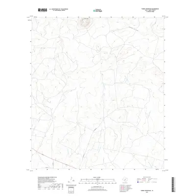
2019 Map of Turkey Mountain
USGS Topo · Published 2019About this map
Turkey Mtn rises as a prominent landmark in this corner of Kinney County, presiding over a landscape defined by the intricate drainage systems of the Nueces River basin. The terrain is deeply etched by the seasonal watercourses of Arenosa Cr and Rough Hollow, while the bifurcated paths of E Fork Turkey Cr and W Fork Turkey Cr suggest the natural corridors used for navigation and ranching in this part of Southwest Texas. While the area remains largely undeveloped, the presence of named access routes such as Schubach Ln and Bustn Ln indicates the sparse but enduring network of rural landholdings and private ranching interests that have shaped the local geography into the twenty-first century.
Find a feature on this map
7 named features on this map. Tap any name to fly to it.
Don’t see what you’re looking for? This feature index may not catch every label — zoom into the map to look around manually.
Map Details
Editions of this 2019 Turkey Mountain Map
This is the sole edition of this map. No revisions or reprints were ever made.
Other maps of this area

1896 · Brackett
USGS Topo · 1:125,000

1897 · Brackett
USGS Topo · 1:125,000

1938 · Turkey Mountain
USGS Topo · 1:48,000

1943 · Turkey Mountain
USGS Topo · 1:62,500

1944 · Spofford
USGS Topo · 1:62,500

1944 · Brackettville
USGS Topo · 1:62,500

1949 · Cline
USGS Topo · 1:62,500

1958 · Del Rio
USGS Topo · 1:250,000

1964 · Del Rio
USGS Topo · 1:250,000
1974 · Elm Mountain
USGS Topo · 1:24,000