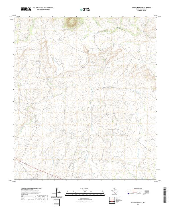
2022 Map of Turkey Mountain
USGS Topo · Published 2022About this map
Turkey Mtn rises as the central landmark in this southwestern Texas landscape, situated within a network of seasonal watercourses and local ranch roads. The drainage patterns of the area are clearly defined by the diverging branches of W Fork Turkey Cr and E Fork Turkey Cr to the east, while Arenosa Cr and Rough Hollow carve the terrain to the west and north. This modern survey reflects the enduring rural character of Kinney County, where human presence is marked primarily by private access routes such as Schubach Ln and Bustin Ln. The map detail captures the intersection of arid rangeland hydrology and the infrastructure of modern cattle ranching, providing a clear record of the area's physical geography.
Find a feature on this map
8 named features on this map. Tap any name to fly to it.
Don’t see what you’re looking for? This feature index may not catch every label — zoom into the map to look around manually.
Map Details
Editions of this 2022 Turkey Mountain Map
This is the sole edition of this map. No revisions or reprints were ever made.
Other maps of this area

1896 · Brackett
USGS Topo · 1:125,000

1897 · Brackett
USGS Topo · 1:125,000

1938 · Turkey Mountain
USGS Topo · 1:48,000

1943 · Turkey Mountain
USGS Topo · 1:62,500

1944 · Spofford
USGS Topo · 1:62,500

1944 · Brackettville
USGS Topo · 1:62,500

1949 · Cline
USGS Topo · 1:62,500

1958 · Del Rio
USGS Topo · 1:250,000

1964 · Del Rio
USGS Topo · 1:250,000
1974 · Elm Mountain
USGS Topo · 1:24,000