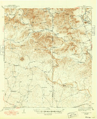
1943 Map of Turkey Mountain
USGS Topo · Published 1949About this map
The West Nueces River and the Nueces River dominate this 1938 survey of the borderlands between Kinney and Uvalde counties. This landscape is defined by its deep canyons and named hollows, where water sources like Mustang Waterhole and Edwards Waterhole were critical to the local ranching economy. The map identifies numerous family-run operations, including the Harrison Ranch Headquarters, Veltman Ranch, and Whitecotton Ranch, reflecting a sparsely populated but active livestock region. Prominent peaks such as Turkey Mountain, Double Mountain, and Salmon Pk provide significant landmarks across the rugged terrain. Along the Brackettville Road, a modest community infrastructure is visible at the Live Oak Sch and nearby Cem, while the Southern Pacific Railroad skirts the southern edge of the quadrangle, linking these remote ranchlands to wider markets.
Find a feature on this map
77 named features on this map. Tap any name to fly to it.
Don’t see what you’re looking for? This feature index may not catch every label — zoom into the map to look around manually.
Map Details
Editions of this 1943 Turkey Mountain Map
2 editions found
Other maps of this area

1893 · Nueces
USGS Topo · 1:125,000

1896 · Nueces
USGS Topo · 1:125,000

1896 · Brackett
USGS Topo · 1:125,000

1897 · Brackett
USGS Topo · 1:125,000

1898 · Uvalde
USGS Topo · 1:125,000

1899 · Uvalde
USGS Topo · 1:125,000

1938 · Turkey Mountain
USGS Topo · 1:48,000

1943 · Turkey Mountain
USGS Topo · 1:62,500

1944 · Barksdale
USGS Topo · 1:62,500

1944 · Spofford
USGS Topo · 1:62,500