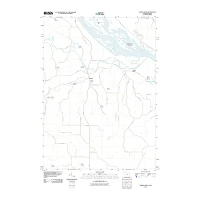
2010 Map of Turkey River
USGS Topo · Published 2010About this map
Mississippi River backwaters and the winding course of the Turkey River define this riverine landscape at the border of Iowa and Wisconsin. The river's influence is evident in the numerous islands and sloughs, including Island 189, Island Number One Hundred Ninety-two, and Cassville Iowa Slough. On the Iowa side, the small settlement of Millville sits near the confluence of the Little Turkey River and the main branch, surrounded by narrow valleys like Andregg Hollow and Hog Hollow. For those researching local families, the map is remarkably dense with burial sites, including Saint Johns Cemetery, Rodman Cemetery, and Goshen Cemetery. The Wisconsin shoreline is dominated by the blufflands of Nelson Dewey State Park, where Dewey Creek meets the river. The road network, including the Great River Rd and Pumpkin Ridge Rd, follows the difficult topography of the river bluffs and deep interior hollows.
Find a feature on this map
51 named features on this map. Tap any name to fly to it.
Don’t see what you’re looking for? This feature index may not catch every label — zoom into the map to look around manually.
Map Details
Editions of this 2010 Turkey River Map
This is the sole edition of this map. No revisions or reprints were ever made.
Other maps of this area

1900 · Lancaster
USGS Topo · 1:125,000

1902 · Elkader
USGS Topo · 1:125,000

1904 · Lancaster
USGS Topo · 1:125,000

1908 · Lancaster
USGS Topo · 1:125,000

1955 · Cassville
USGS Topo · 1:24,000

1957 · Turkey River
USGS Topo · 1:24,000

1957 · Colesburg
USGS Topo · 1:24,000

1957 · Holy Cross
USGS Topo · 1:24,000

1959 · Dubuque
USGS Topo · 1:250,000

1961 · Dubuque
USGS Topo · 1:250,000