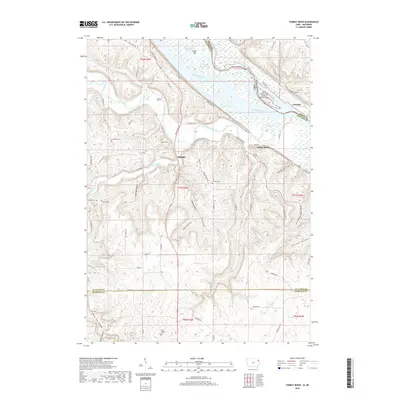
2018 Map of Turkey River
USGS Topo · Published 2018About this map
The Mississippi River creates a complex landscape of islands and sloughs along the border of Iowa and Wisconsin, where the Turkey River meets the larger waterway. This 2018 survey documents the intricate geography of the riverbottoms, including Island Number One Hundred Ninety-two and Island 189, alongside several side channels like Skimmethom Slough and Cassville Iowa Slough. The land rises sharply from the floodplains into a series of deeply carved valleys such as Adams Mill Hollow and Hog Hollow. For those tracing local history, the map identifies several rural landmarks and family-named cemeteries including Bierer Cem, Redman Cem, and Goshen Cem. The small settlement of Millville sits at a strategic junction inland, while Cassville marks the riverfront edge, reflecting the enduring connection between these communities and the river navigation and valley farming that shaped the region.
Find a feature on this map
69 named features on this map. Tap any name to fly to it.
Don’t see what you’re looking for? This feature index may not catch every label — zoom into the map to look around manually.
Map Details
Editions of this 2018 Turkey River Map
This is the sole edition of this map. No revisions or reprints were ever made.
Other maps of this area

1900 · Lancaster
USGS Topo · 1:125,000

1902 · Elkader
USGS Topo · 1:125,000

1904 · Lancaster
USGS Topo · 1:125,000

1908 · Lancaster
USGS Topo · 1:125,000

1955 · Cassville
USGS Topo · 1:24,000

1957 · Turkey River
USGS Topo · 1:24,000

1957 · Colesburg
USGS Topo · 1:24,000

1957 · Holy Cross
USGS Topo · 1:24,000

1959 · Dubuque
USGS Topo · 1:250,000

1961 · Dubuque
USGS Topo · 1:250,000