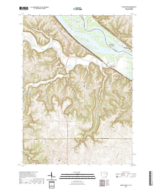
2022 Map of Turkey River
USGS Topo · Published 2022About this map
The confluence of the Turkey River and the Mississippi River shapes this corner of Clayton County, Iowa, and Grant County, Wisconsin. Near the riverbanks, the settlement of Millville sits at the junction of several valley roads, while across the water, the Cassville Car Ferry provides a critical link to Cassville. The terrain is defined by deep hollows such as Adams Mill Hollow, Panther Hollow, and Hog Hollow, where the landscape transitions into high ridges including Jolly Ridge and Pumpkin Ridge. For genealogists, the map is particularly rich in family-named burial sites, including Bierer Cem, Friedlein Cem, Redman Cem, Graham Cem, Griffith Cem, and the Myer Property Cem. This survey illustrates the relationship between the rugged bluff geography and the small-scale infrastructure of river crossings and rural cemeteries that characterized the region in the early 2020s.
Find a feature on this map
68 named features on this map. Tap any name to fly to it.
Don’t see what you’re looking for? This feature index may not catch every label — zoom into the map to look around manually.
Map Details
Editions of this 2022 Turkey River Map
This is the sole edition of this map. No revisions or reprints were ever made.
Other maps of this area

1900 · Lancaster
USGS Topo · 1:125,000

1902 · Elkader
USGS Topo · 1:125,000

1904 · Lancaster
USGS Topo · 1:125,000

1908 · Lancaster
USGS Topo · 1:125,000

1955 · Cassville
USGS Topo · 1:24,000

1957 · Turkey River
USGS Topo · 1:24,000

1957 · Colesburg
USGS Topo · 1:24,000

1957 · Holy Cross
USGS Topo · 1:24,000

1959 · Dubuque
USGS Topo · 1:250,000

1961 · Dubuque
USGS Topo · 1:250,000