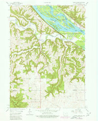
1957 Map of Turkey River
USGS Topo · Published 1980About this map
The confluence of the Turkey River and the Mississippi River dominates this mid-century survey of the Iowa-Wisconsin borderlands. Steep bluffs and deep-cut ravines like Adams Mill Hollow and Cherry Valley define the landscape, which is largely preserved within the Upper Mississippi River Wildlife and Fish Refuge. The settlement of Millville sits nestled at the junction of the main river and the Little Turkey River, while the rail corridor of the Chicago Milwaukee St Paul and Pacific traces the winding riverbank. This map provides a detailed view of the rural infrastructure of Clayton County, including family-named sites such as Andregg Hollow and local landmarks like Goshen Ch. The southern portion of the map showcases the protected timber of White Pine Hollow State Park, a stark contrast to the active industrial traces like the Quarry near the Millville township line.
Find a feature on this map
36 named features on this map. Tap any name to fly to it.
Don’t see what you’re looking for? This feature index may not catch every label — zoom into the map to look around manually.
Map Details
Editions of this 1957 Turkey River Map
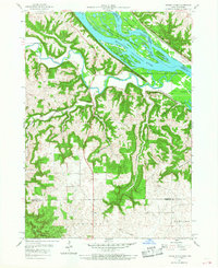
Other maps of this area

1900 · Lancaster
USGS Topo · 1:125,000

1902 · Elkader
USGS Topo · 1:125,000

1904 · Lancaster
USGS Topo · 1:125,000

1908 · Lancaster
USGS Topo · 1:125,000

1955 · Cassville
USGS Topo · 1:24,000

1957 · Turkey River
USGS Topo · 1:24,000

1957 · Colesburg
USGS Topo · 1:24,000

1957 · Holy Cross
USGS Topo · 1:24,000

1959 · Dubuque
USGS Topo · 1:250,000

1961 · Dubuque
USGS Topo · 1:250,000