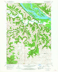
1957 Map of Turkey River
USGS Topo · Published 1968About this map
The Mississippi River and the winding Turkey River converge at the heart of this mid-century survey, defining a landscape of high ridges and deep ravines along the Iowa-Wisconsin border. On the Iowa side, the settlement of Millville serves as a small hub amidst a rugged network of named drainages like Anderegg Hollow and Cherry Valley. The Chicago Milwaukee St Paul and Pacific railroad tracks follow the river contours, supporting the regional economy of the day. For local historians, the presence of St Johns Cem, Friedlein Cem, and Goshen Ch provide specific points of interest for family research. Extensive protected areas, including the Upper Mississippi River Wildlife and Fish Refuge and White Pine Hollow State Park, illustrate the importance of conservation and the preservation of river islands like Island 189.
Find a feature on this map
37 named features on this map. Tap any name to fly to it.
Don’t see what you’re looking for? This feature index may not catch every label — zoom into the map to look around manually.
Map Details
Editions of this 1957 Turkey River Map
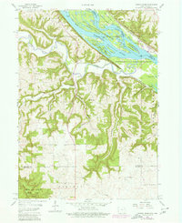
Other maps of this area

1900 · Lancaster
USGS Topo · 1:125,000

1902 · Elkader
USGS Topo · 1:125,000

1904 · Lancaster
USGS Topo · 1:125,000

1908 · Lancaster
USGS Topo · 1:125,000

1955 · Cassville
USGS Topo · 1:24,000

1957 · Turkey River
USGS Topo · 1:24,000

1957 · Colesburg
USGS Topo · 1:24,000

1957 · Holy Cross
USGS Topo · 1:24,000

1959 · Dubuque
USGS Topo · 1:250,000

1961 · Dubuque
USGS Topo · 1:250,000